Year: 2012.
Status: Complete and approved by customer.
Objectives:
- To carry out general comprehensive survey of 460 square kilometers as per scope of works;
- Determine seabed conditions, exact pipelines location/routes, pipeline crossing, sea depths (bathymetry), location details of platforms for future engineering activities.
General seabed survey
General seabed survey includes multibeam echosounder and side scan sonar survey:
- Identifying all obstructions and other debris;
- Determination of routes pipelines with coordinates;
- Determination of pipelines crossings.
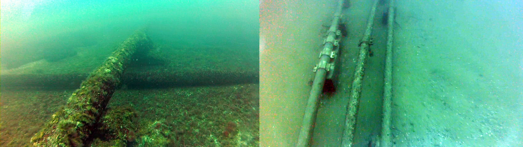
Operational pipelines and risers survey
Operational pipelinesa and risers survey includes side scan sonar and multibeam echosounder survey along the pipelines routes:
- Determination of actual position of pipelines and risers;
- Route survey with determination of abnormalities along pipelines routes;
- Checking and reporting of any crossings.
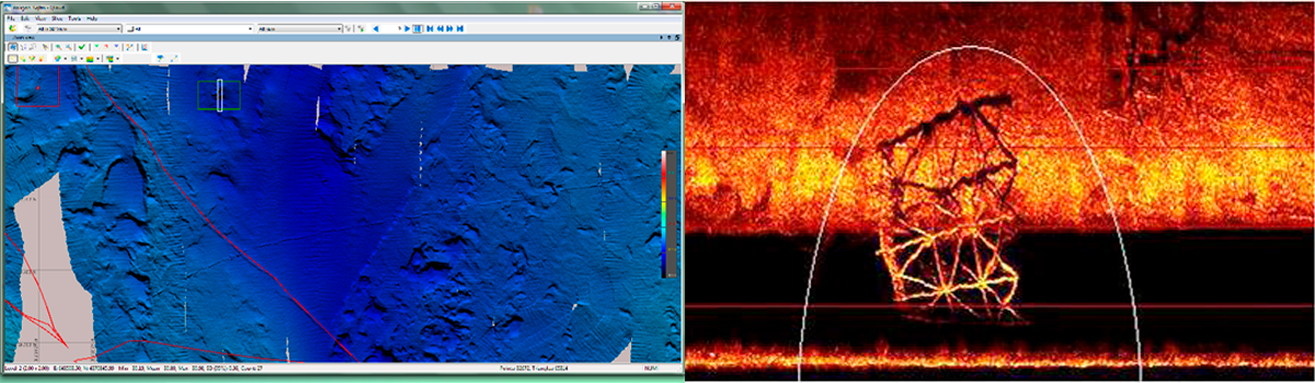
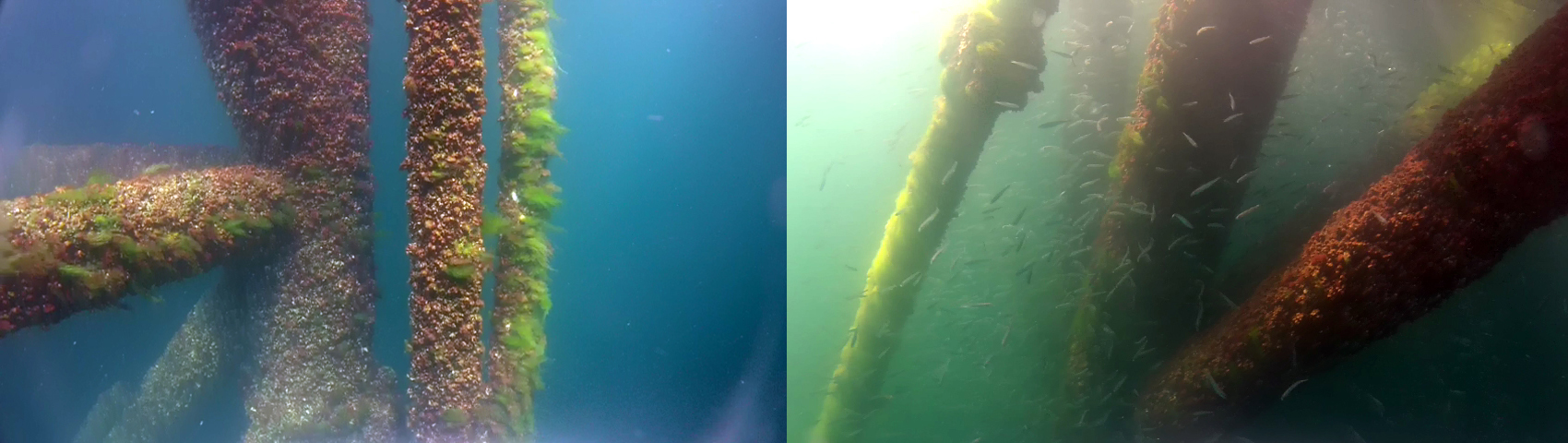
Operating platform survey
Operating platforms survey include sidescan sonar and multibeam echosounder survey (seabed area around 200 meters) and diving inspection of abnormalities:
- Determination of platforms location using DGPS survey;
- Determination of seabed condition around platforms area of 200 meters with abnormalities reporting.

Diving survey
- Inspection and survey of operating risers;
- Inspection of operating pipelines including crossing and abnormalities along of pipelines routes 5 meters stripe;
- Identification and inspection of debris on the seabed that was found before by scanner.
Summary:
- During the survey was made bathymetry for all area for bathymetry mapping;
- All facilities on the seabed were reported with coordinates and description;
- Based on scanner data and diving survey materials detailed reports was issued – maps, 3D models, drawings, operational platforms plans, pipelines profiles, routes, abnormalities reports etc;
- The 24 operational platforms was inspected during the project;
- Area around operating platforms was surveyed by scanner and divers;
- Top side of all operating platforms were measured by DGPS system for exact maping;
- During the contract, 58 operating pipelines was surveyed by scanners and by divers – routes, crossings, coordinates;
- Non-commisioned pipelines was also inspected;
- As result of survey was no found critical damages on operating pipelines;
- Only abandoned (flexible) pipelines have critical damages;
- 50 non operational pipelines was surveyed by scanners and divers in order to receive exact coordinates;
- All pipelines was mapped on general and sectors maps.
- 156 debris location was found during the survey, all of them were surveyed and reported with description, sizes, coordination.
- According to received survey data, 3D model of seabed was developed.
- 3D model can be used for future engineering activities.